
SURFSIDE SCIENCE: Validating satellite-based seafloor maps on small islands
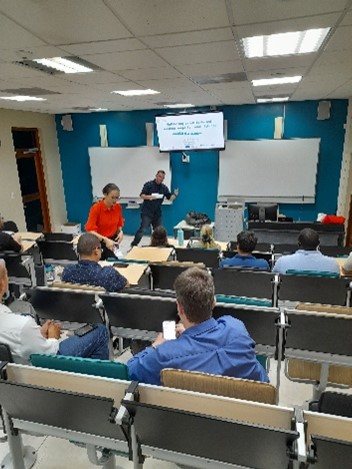

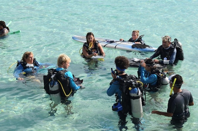
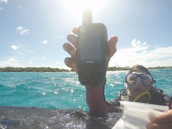
A presentation given by Tatiana Becker during an activity of the KIVI Kring Caribbean – Aruba at the University of Aruba highlighted how to get spatial environmental data in a relatively simple and cheap way. This is especially valuable for Small Island Development States (SIDS) like Aruba which are lacking financial resources for environmental monitoring. Surfside Science, a project piloted at the Surfside Beach of Aruba, demonstrated this and the results are there. The seafloor maps generated from classifying satellite data were tested for their accuracy via GPS-tracked photographic surveys that were conducted with the help of divers from ScubbleBubble foundation on Aruba (ScubbleBubble is a non-profit foundation that focuses on getting local youth of the Aruban community involved in ocean conservation activities). Comparing these two sources of data, the satellite-based seafloor maps have been validated. Before the satellite data was validated,
Tatiana Becker developed a classification system to standardize the photo classification/ interpretation process. The accuracy of this validation was about 60.5% which is considered a moderate accuracy. It was demonstrated to have a higher accuracy and or precision than existing seafloor maps for the area. Furthermore, the data collected are transparently accessible at the data portal Data Portal (brenchies.com) One can make their own trend analysis using these data.
More information about low-cost methods used to monitor a range of environmental parameters like air quality, water quality and the reef island coverage can be found on Surfside Science – Exploring replicable methods for coastal environmental monitoring (brenchies.com)
You can find the sheets of the presentation under 'Documenten'

KIVI KRING CARRIBBEAN – ARUBA invites you to attend its activity with the following title:
“SURFSIDE SCIENCE: VALIDATING SATELLITE-BASED SEAFLOOR MAPS ON SMALL ISLANDS”
Communities living in Small Island Development States (SIDS) like Aruba are heavily dependent on the ecosystem services that are offered by various coastal habitats, such as seagrass meadows and coral reefs. These habitats are undergoing rapid changes due to a variety of global, regional and local human and natural stressors, such as climate change, coastal development, pollution, overfishing etc.
Nevertheless, many SIDS lack knowledge and data about the state of their marine environments. To monitor and detect changes in seafloor habitats, satellite-based seafloor maps can provide a cost-effective and open-access approach. However, the accuracy of this remote sensing method needed to be validated.
The role of Tatiana Becker during the Surfside Science project was to validate open-source satellite-derived seafloors maps created for the urbanized bay Surfside in Aruba making use of relatively simple sea-truthing methods. As such with the aim to verify and validate the seafloor habitat classifications from Sentinel 2 satellite imagery.
The accuracy of the satellite-based method has implications for the conservation and research of valuable coastal systems concerning monitoring capacity, access, and financial requirements associated with long-term coastal monitoring. By doing this study Surfside Science wish to empower SIDS communities to monitor their coastal environments.
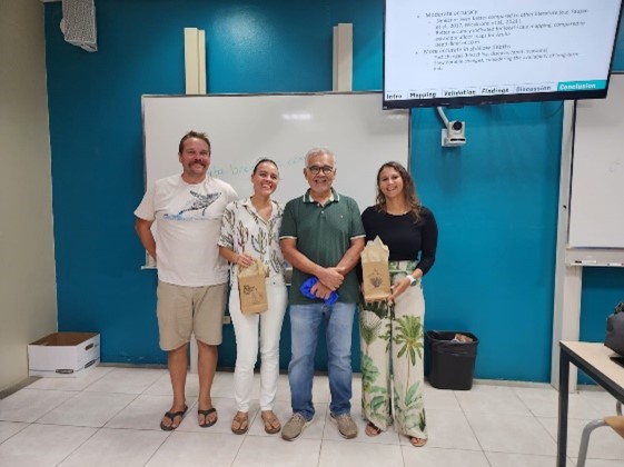
Who is Tatiana Becker? .

Tatiana Becker is a marine ecologist / environmental researcher. She obtained her Master of Science degree in Marine Ecology and Resource Management at the University of Wageningen. Currently she teaches STEM (Science, Technology, Engineering and Mathematics) courses at the Academic Foundation Year for the University of Aruba.
KIVI KRING Caribbean - Aruba invites all engineers and others interested to attend this presentation to get more insight in the most recent research on marine ecosystem at Surfside Aruba and to get an idea how to use satellite imaging for monitoring such ecosystems. This research provides the first data on the state of marine ecosystem for Aruba.
This activity will take place at the University of Aruba in room A at Juancho Irausquin Plein 4, Oranjestad on Thursday February 29, 2024 at 7 to 8 p.m. followed by KIVI’s networking session from 8 – 9:00 p.m. while enjoying a drink and a snack. An entrance fee of 20 AWG florins is charged to KIVI members to cover the costs while non-members are charged 25 AWG fls. There is a free entrance for students at the University of Aruba while the entrance fee for the PhD candidates is 10 AWG fls. You can register via the KIVI website.
Join Tatiana Becker on Thursday the 29th at the University of Aruba to hear about her process in validating the low-cost methods we use to monitor things like air quality and shallow sea-floor coverage with science.brenchies.com. Look at the data we're collecting at data.brenchies.com.